Key Facts About the Rio Grande River: Geography and Significance Explained
This work has been verified by our teacher: 30.03.2026 at 17:22
Type of homework: Geography Essay
Added: 27.03.2026 at 8:59
Summary:
Explore key facts about the Rio Grande River’s geography and significance to understand its course, basin, and vital role in North American ecology and culture.
10 Lines on Rio Grande River: A Comprehensive Overview
Rivers have, since ancient times, been the lifelines of civilisations. In India, we regard rivers such as the Ganga and Yamuna not only as water bodies but as sacred entities that nurture our land, culture, and economy. Similarly, on distant shores in North America, the Rio Grande River flows as an artery of life, carrying with it stories of ancient traditions, borderlands, and environmental challenges. Though it may not be as widely discussed in Indian textbooks as our own rivers, a careful look at the Rio Grande reveals many parallels and valuable lessons for students and educators alike. Through this essay, I will offer an original and in-depth exploration of ten essential aspects of the Rio Grande, weaving together its geography, history, ecology, and the socio-political dynamics that shape its course.
---
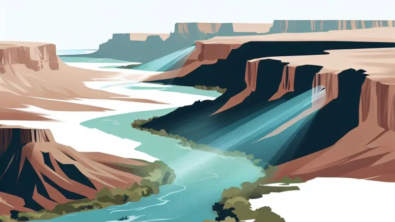
1. Geographic Origin and Setting
The Rio Grande, whose name in Spanish means “Great River,” originates from the snow-capped San Juan Mountains in southern Colorado, United States. Much like how the Yamuna rises from the Yamunotri glacier in the Himalayas, this river begins its journey in a region dominated by towering peaks and rugged, pristine landscapes. The birth of the Rio Grande is shaped by high-altitude climatic conditions, with melting snow providing a steady supply of freshwater that feeds the infant stream. The source is situated over 3,650 metres above sea level, making the Rio Grande’s beginnings as dramatic and vital as those of many revered Indian rivers.---
2. Length and Course of the River
Winding its way across approximately 3,051 kilometres, which is almost comparable to the Ganga’s 2,510 kilometres, the Rio Grande charts an impressive path through diverse terrains. After originating in Colorado, it flows southwards through the deserts of New Mexico and then turns southeast, forming much of the border between the U.S. state of Texas and Mexico. Eventually, the river empties into the Gulf of Mexico, just as the Godavari flows eastward to meet the Bay of Bengal. Along this journey, the river passes through arid plains, steep canyons, and urban sprawls, each stretch adding new dimensions to its identity.---
3. Basin and Tributaries
The expansive Rio Grande Basin covers an area that can range from 182,000 square kilometres to over 470,000 square kilometres, depending on the definition used. This is somewhat smaller than the Ganga basin yet remains significant. The river is sustained by numerous tributaries, with the Rio Conchos from Mexico being the most prominent, much like the Yamuna’s contribution to the Ganga. Other vital feeders include the Pecos River and the San Juan River, collectively shaping the hydrology of vast regions in both the US and Mexico. The basin’s health is crucial for the populations depending on it—a truth Indians understand well from our own experiences with inter-state river basins.---
4. Cultural and Historical Significance
For centuries, before modern borders were drawn, the Rio Grande was a witness to the migration and settlement of indigenous peoples. The river, called “Río Bravo del Norte” in Mexico, meaning “Wild River of the North,” was at the heart of many legends, battles, and trade routes. Its waters not only quenched the thirst of tribes but enabled the growth of settlements much as the Indus and Saraswati shaped the earliest Indian civilisations. Later, during the 19th century, the Rio Grande’s banks became contested ground during the Texas-Mexico wars, symbolising both division and connection, a theme mirrored in Indian history across the branches of the Sutlej and Ravi.---
5. International Boundary and Cross-border Relations
Uniquely, for over 2,000 kilometres, the Rio Grande serves as the natural boundary between Mexico and the United States. Sibling to India's own international rivers like the Brahmaputra (shared with China and Bangladesh) and the Indus (shared with Pakistan), the Rio Grande’s role in marking territory is rife with diplomatic significance. Cities such as El Paso in the US and Ciudad Juárez in Mexico are built as twins on either side, with the river both linking and dividing people, much as the Wagah border divides Amritsar and Lahore. Daily life along these borderlands is a testament to shared heritage, frequent cultural exchanges, and at times, tense negotiation over water sharing and migration.---
6. Ecological Wealth and Biodiversity
The Rio Grande basin, much like the forests and wetlands of the Sundarbans in the Ganga delta, is home to a rich variety of flora and fauna. Its riparian zones support willows, cottonwoods, and a number of aquatic plants. Wildlife, such as the endangered Rio Grande silvery minnow, otters, and bird species including herons and kingfishers, rely directly on the health of the river system. Conservationists have drawn parallels with efforts to protect the Gharial or Gangetic Dolphin here in India, recognising the delicate balance between human needs and ecological preservation. Over the decades, habitat loss and pollution have spurred numerous cross-border conservation programmes, such as those led by the US-Mexico International Boundary and Water Commission.---
7. Role in Agriculture and Urban Development
Just as the rivers of the Indo-Gangetic plains are harnessed for irrigation, the Rio Grande is the lifeblood for agriculture across the American Southwest and northern Mexico. Its waters irrigate nearly 2,100,000 acres of land, supporting crops such as cotton, grapes, citruses, alfalfa, and vegetables. Urban centres like Albuquerque, Laredo, and Brownsville have grown up along its banks, dependent on its flows for drinking water, industry, and recreation. This interplay of natural bounty and human ambition finds echoes in India’s own battle for water security in cities like Delhi and Kanpur.---
8. Environmental Challenges and Management
In recent years, the Rio Grande has faced acute pressure from over-extraction, diminishing flows, pollution from industries and agriculture, and the mounting impacts of climate change. Evoking the grim fate of several Indian rivers reduced to trickles in peak summer, the Rio Grande has at times failed to reach the sea. Dams such as the Elephant Butte Reservoir and Falcon Amistad have been both solutions and problems: while they provide flood control and water for irrigation, they interrupt natural flow and alter the ecosystem. There are ongoing efforts, similar to India’s National Mission for Clean Ganga, aimed at restoration through habitat protection and stricter pollution regulation, though the path ahead is steep.---
9. A Site of Political Negotiation and Legal Frameworks
Transboundary rivers naturally foster both cooperation and conflict. Several treaties, most notably the 1944 Water Treaty, have been signed between the US and Mexico to apportion river water and manage its use. The International Boundary and Water Commission, a joint US-Mexican body, is tasked with resolving disputes on water sharing, flood control, and environmental matters. These arrangements are not unlike the Indus Waters Treaty between India and Pakistan, illustrating the universality of challenges in managing shared river resources. Political tensions arise regularly, whether due to drought, overuse, or ecological mishaps, necessitating constant negotiation and innovation.---
10. The Future of the Rio Grande: Lessons for All
The Rio Grande’s story is an urgent reminder of the fragility of rivers worldwide. Population growth, shifting climate patterns, mounting industrial pressures, and cross-border conflicts place a heavy strain on its waters. Yet, amidst these challenges, communities, scientists, and governments are responding with technological advancements, policy reforms, and a growing ethos of environmental stewardship. Initiatives in efficient irrigation, sustainable urban planning, and educational campaigns, if successful, could become models for river conservation efforts everywhere—including here in India, where rivers are both lifelines and sacred trusts.---
Rate:
Log in to rate the work.
Log in