Key Facts About Ghaggar River: Geography, History and Importance
This work has been verified by our teacher: 16.04.2026 at 11:19
Type of homework: Geography Essay
Added: 15.04.2026 at 14:49
Summary:
Explore key facts about the Ghaggar River’s geography, history, and importance to understand its seasonal flow and cultural role in India’s landscape.
10 Lines on Ghaggar River: An In-depth Study of its Geography, History, and Significance
The tapestry of Indian civilisation is intertwined with its rivers, which have served not just as physical markers, but as cradles of culture and ancient wisdom. Among the many rivers that have left a profound mark on the Indian subcontinent is the Ghaggar River, often shrouded in layers of myth, history, and geographical intrigue. Unlike the mighty perennial rivers of the north, such as the Ganga or the Yamuna, the Ghaggar is a seasonal river, yet its story runs deep, echoing through millennia of human endeavour and natural evolution. This essay endeavors to explore the Ghaggar River in comprehensive detail, examining its origins, hydrological features, historical importance, cultural resonance, environmental challenges, and its place among the rivers of India.---
Geographical Origin and Course of the Ghaggar River
The Ghaggar rises from the lower Himalayan region, specifically the Shivalik Hills in Himachal Pradesh. Its precise origin is often attributed to the slopes near Dagshai or Kalka, with the river springing to life at elevations of about 600-900 metres above sea level. The Shivalik foothills, with their undulating terrain and monsoon-fed rivulets, provide an ideal setting for the birth of such a stream. This land is not just picturesque but possesses a unique fragility, being prone to soil erosion and seasonal shifts, which in turn shape the very character of the river.Upon emerging, the Ghaggar meanders southwards, first through parts of Himachal Pradesh, then flowing through Punjab—here, the river's spread is evident but often limited to the monsoon season. As it crosses into Haryana, especially districts like Yamunanagar, Ambala, and Sirsa, the riverbed becomes broader, and the river interacts directly with agricultural settlements. Eventually, it heads into the arid expanses of north-eastern Rajasthan, traversing areas like Hanumangarh and Ganganagar, where its waters are eagerly awaited by local farmers. Beyond the Indian border, the Ghaggar continues into Pakistan, taking the name Hakra (or Hakro Darya), and ultimately disappears into the thirsty sands of the Cholistan and Bahawalpur regions of the Thar Desert.
One defining aspect of the Ghaggar is its seasonality. Unlike Himalayan glaciers-fed rivers, Ghaggar's flow depends almost entirely on the South-Western monsoon; for much of the year, its broad bed lies dry and sandy, filled only during the brief monsoon months, transforming from a trickle to a mighty torrent in a matter of days—an eloquent testimony to the region’s climatic oscillations.
---
Tributaries and the Hydrological Network
The Ghaggar’s journey is enriched by several tributaries, weaving a complex tapestry of rainfall patterns and regional hydrography. The Kaushalya River, joining from the left in Haryana, provides significant inflow, especially during monsoon spells. On the right, rivers like Markanda, Sarsuti, Tangri, and Chautang—many of which too are ephemeral in nature—augment the volume.These tributaries, many of them draining the lower Himalayan slopes or foothills, unite in the plains to birth a dramatic hydrological network. During the rainy season, these rivers collectively transform the Ghaggar’s modest channel into a broad ribbon of fast-flowing water, often flooding low-lying landscapes and replenishing aquifers. This sharp influx is crucial for the regional ecosystems, feeding wetlands and sustaining flora and fauna adapted to the annual flood pulse. In an agrarian context, the inflow from tributaries is vital for irrigation, particularly in the parched districts downstream, shaping patterns of cropping and rural livelihoods.
---
Historical and Archaeological Importance
No discussion of the Ghaggar can proceed without acknowledging its central place in the historical and archaeological record. The Ghaggar is often romanticised as the possible vestige of the fabled Saraswati River, which finds frequent mention in the Rigveda and other ancient scriptures. While the debate continues amongst geologists and historians, the evidence of extensive ancient human activity along the Ghaggar-Hakra belt is undeniable.Numerous archaeological findings, especially from the latter half of the 20th century, have highlighted the river’s basin as a veritable cradle of the Indus Valley (or Harappan) Civilisation. Sites such as Kalibangan, Banawali, and Rakhigarhi—now household names in Indian history textbooks—lie along its banks or in close vicinity. These sites bear remnants of meticulously planned cities, baked brick houses, and sophisticated drainage systems, signifying a society in active dialogue with its riverine environment.
Geological records suggest that until a few thousand years ago, the Ghaggar may have received significant inflows from the Sutlej and perhaps the Yamuna, contributing to its perennial flow. Over time, changes in tectonic activity and river capture altered these courses, leading to a gradual desiccation of the river and a corresponding decline in the settlements that once depended on its waters. This historical narrative underscores the fragile, dynamic dance between nature and civilisation in the subcontinent.
---
Socio-Economic and Cultural Relevance
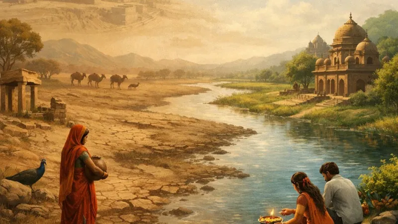
Even today, the Ghaggar’s influence looms large over the societies that fringe its seasonal bed. For residents of Haryana and Rajasthan, this river is a life-giver—its monsoon floods replenish groundwater, nourish fields, and support livelihoods in areas otherwise plagued by aridity and water scarcity. The annual rhythm of the river determines the agricultural calendar, and though modern canal networks supplement irrigation, the river’s arrival is awaited with anticipation.Culturally, the Ghaggar occupies a special niche in local lore. In parts of Haryana and Rajasthan, stories abound of the river’s ancient glory and capricious temperament—its floods interpreted variously as boon and bane. Folk songs, particularly in northwestern India, refer to the river as a symbol of transient fortune, and its name weaves through regional mythologies alongside tales of the lost Saraswati. Rituals conducted at local ghats, especially during festivals like Teej and local melas, attest to the river's continuing spiritual resonance.
The river also marks axes of settlement, influencing both historical town-building and contemporary population patterns. Towns such as Sirsa, Fatehabad, and Hanumangarh owe their very existence and prosperity to the proximity of the Ghaggar and its former water bounty.
---
Environmental Concerns and Conservation Efforts
Yet, like many Indian rivers, the Ghaggar faces numerous environmental challenges. Its seasonal flow now contends with reduced rainfall, irregular monsoons spurred by climate change, and rampant extraction for urban and agricultural use. During summer, large stretches of the riverbed lie dry, sometimes used for sand mining or squatted upon, leading to habitat loss and groundwater depletion.Pollution too poses a threat—municipal waste, untreated effluents, and accumulation of plastics mar the river’s ecological health. Invasive weeds and siltation further compound the pressures on native biodiversity. Thus, both the river and its dependent communities are enmeshed in a web of ecological vulnerability.
Efforts are underway on multiple fronts. State governments have initiated rainwater harvesting campaigns, rejuvenation drives, and community-based cleaning efforts. Local NGOs work with farmers to promote judicious water use and discourage indiscriminate dumping. Afforestation along the banks is promoted to bind the soil and regulate runoff. However, true revival will require continued vigilance, cooperation across state lines (and with Pakistan, downstream), and public-awareness campaigns to mobilise youth and elders alike.
---
Comparing Ghaggar with Other Indian Rivers
A salient way to understand the uniqueness of Ghaggar is by setting it alongside India’s other rivers. Perennial rivers like the Sutlej, Yamuna, or Brahmaputra enjoy year-round flows, thanks to glacial and snowmelt sources. In contrast, the Ghaggar typifies the “seasonal river” syndrome, depending mainly on monsoonal rains, a fate it shares with many rivers of central and western India.Management of such rivers requires a different framework—emphasising rainwater storage, groundwater recharge, and managed flood drainage. Lessons from the conservation of the Sabarmati in Gujarat or the rejuvenation efforts in semi-arid regions like Bundelkhand offer important insights for the Ghaggar basin.
---
Conclusion
To summarise, the Ghaggar River, though modest in its present-day flow, is an enduring testament to India's intricate natural and cultural heritage. From its scenic origin in the Shivalik foothills, across fertile plains and historic ruins, to its ephemeral end in the sands of the Thar, the river encapsulates the romance and complexity of India’s relationship with water.Its importance lies not just in geography, but in the layers of history, folklore, and economic activity woven around it. In facing modern challenges—be it climate variability, pollution, or overuse—the story of the Ghaggar urges us towards mindful stewardship, sustainable usage, and a reverence for the delicate balance between nature and society.
Let us carry forward both the memory and the lessons of the Ghaggar, ensuring that this ancient river continues to inspire, sustain, and teach generations to come.
---
Note: For further learning, students may refer to the “Atlas of Ancient India” by Mortimer Wheeler, or archaeological reports by the Archaeological Survey of India related to the Ghaggar-Hakra sites. Maps and illustrations can be found in NCERT textbooks, and local oral histories collected from Haryana and Rajasthan add texture to textbook narratives.
Rate:
Log in to rate the work.
Log in